Earth's Secrets Revealed: Scientists Capture Real-Time Moment of an Earthquake's Fury!
Imagine capturing the exact moment the Earth splits open—sounds like something straight out of a sci-fi movie, right? Well, it just became a reality! For the first time, scientists have witnessed the dramatic dynamics of fault slip during a major earthquake, capturing the event in real-time with astonishing clarity.
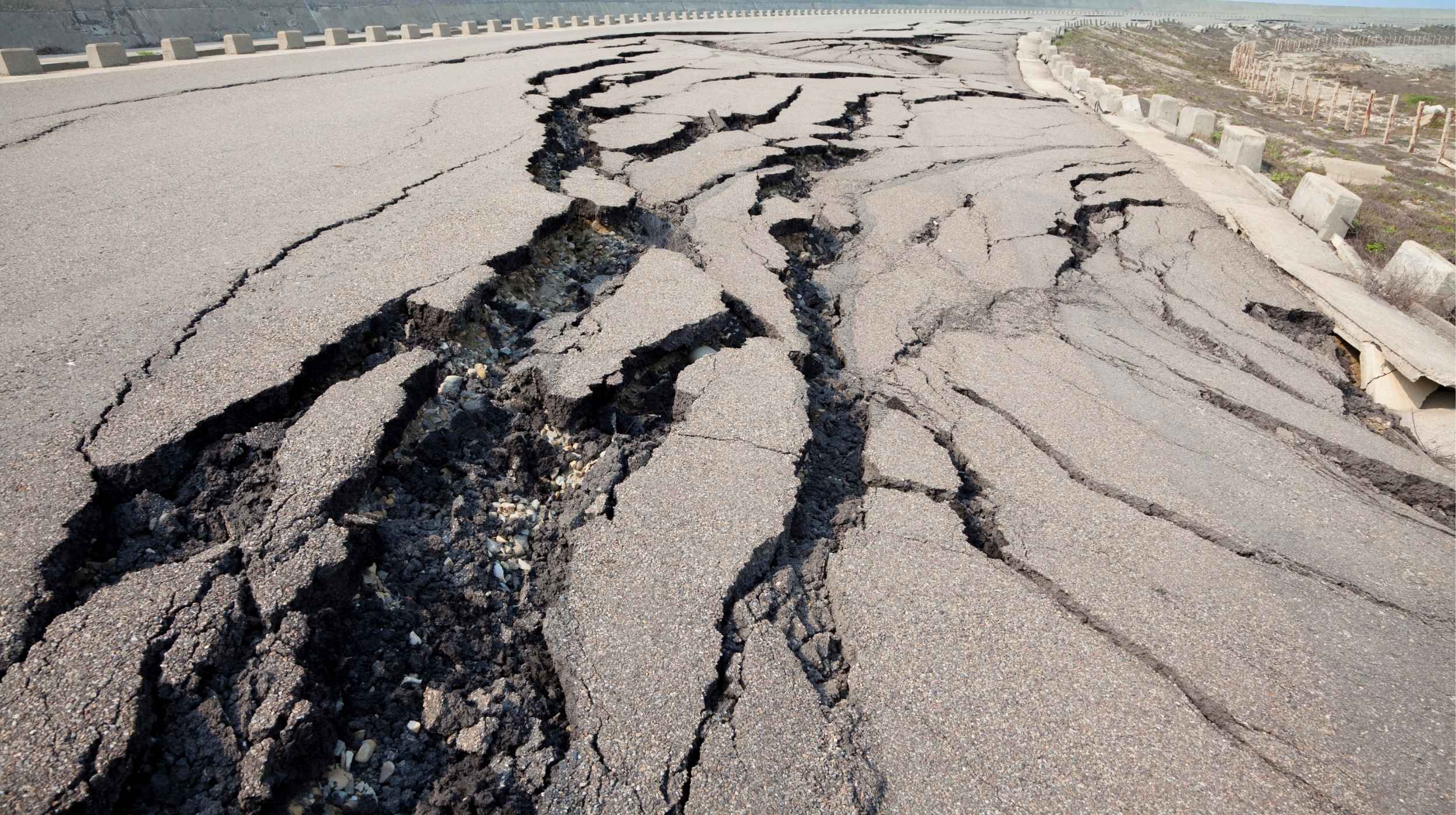
Using CCTV footage from the devastating March 28, 2025 earthquake in Myanmar, researchers observed the moment the ground ruptured. This magnitude 7.7 earthquake began 12.4 miles (20 kilometers) west of Mandalay at a depth of 6.2 miles (10 kilometers). It struck along the Sagaing Fault, a major geological feature that sees two tectonic plates sliding past each other sideways. The quake lasted about 90 seconds and spread both north and south along the fault, resulting in a massive 249 miles (400 kilometers) of the fault slipping, leaving in its wake a fracture that exceeded 6 meters (19.6 feet) in the Earth’s crust. Tragically, this disaster claimed the lives of 3,600 people.
What makes this footage remarkable is that a CCTV camera, initially positioned to monitor the fault, inadvertently turned into a scientific goldmine. Located about 20 meters (65 feet) from the Sagaing Fault and 74.5 miles (120 kilometers) from the quake’s epicenter, this camera recorded the movements in astonishing detail.
Through the footage, researchers revealed that the western side of the fault slid northwards in just about two seconds, forming a mole track—a ridge-like feature resulting from long cracks. By meticulously analyzing each video frame using a method called pixel cross-correlation, they tracked the precise shifts in the Earth's surface. They compared known objects like fence posts to correct for distortion and viewing angle, leading to astonishingly accurate results.
Traditionally, scientists have relied on slickenlines, which are curved scratch marks on fault lines created during an earthquake. These marks provide clues about the earthquake's history and rupture direction, but they only capture a fraction of the slip, often leading to incomplete data. Additionally, geologists typically observe these records days after an event, making it difficult to get an accurate real-time picture of the rupture.
Other tools, such as strong-motion seismometers and high-rate Global Navigation Satellite Systems, have been used to measure ground movements, but these instruments are often positioned away from the fault. This can lead to inaccuracies since they only capture one side of the fault's movement. In the case of the Myanmar earthquake, the main slip occurred in just 1.3 seconds, moving faster than 3 meters per second. This “pulse-like” rupture exhibits a burst of movement followed by sudden halts, a phenomenon scientists have observed in other large earthquakes, but the exact cause of these pauses remains a mystery.
Interestingly, this study provides real-time evidence that curved slickenlines can form during an earthquake itself. The geometry of these curves matched observations from the 2016 Kaikōura earthquake in New Zealand, offering insights that could help enhance our understanding of earthquake dynamics.
In the Kaikōura quake, the slip began at an angle and gradually turned mostly sideways, while in Myanmar, the slip quickly curved before straightening out as it slowed down. Dynamic rupture models predict this behavior, indicating that the curvature arises from dynamic stress related to the direction of rupture propagation.
The study also measured both the on-fault slip velocity and off-fault ground velocity, comparing those to understand how far the fault moves before friction minimizes, known as the slip-weakening distance. The results show that data collected from stations near a fault can represent direct fault measurements effectively, even if the data is a bit noisier.
All these findings pave the way for more accurate future earthquake models, providing scientists with a clearer view of what drives rapid fault movement during significant quakes. The comprehensive study has been published in the journal The Seismic Record, promising to enhance our preparedness for natural disasters in the future.